枕崎市 Makurazaki City
枕崎市は日本本土南端の小さな町です。薩摩半島の南端に位置します。漁業、鰹節生産、お茶の生産などが盛んですが、日本の少子高齢化の波に揺られ、過疎化、若者の減少などの問題があり、頭の痛いところです。
それでも、薩摩が明治維新の際に大きな力を発揮したことを思い出しつつ、写真にてこの地域の紹介を行っていきます。
私は写真家ではありません。過去に撮りためた写真や、時々通りかかった風景を写真に収めた都度に、ご紹介していきたいと思います。
機材:iPhone13 Pro Max
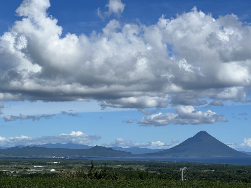
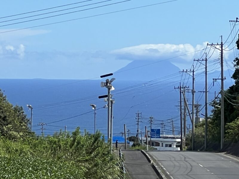
開聞岳 Mt Kaimondake
枕崎市の茅野集落は少し高台にあり、そこから開聞岳、その向こうに大隅半島の山々が眺望できます。
佐多岬と種子島 Cape Sata and Tanegashima
佐多岬(Sata Misaki):
Sata Misaki, also known as Cape Sata, is a picturesque cape located in Kagoshima Prefecture, Japan. It is situated at the southernmost tip of the Satsuma Peninsula and offers breathtaking views of the surrounding coastline and the Pacific Ocean. Sata Misaki is renowned for its rugged cliffs, lush greenery, and the southernmost lighthouse in Japan, known as “Sata Lighthouse” or “Sata-misaki Lighthouse.” It is a popular destination for tourists and nature enthusiasts looking to explore the natural beauty of southern Japan.
種子島(Tanegashima):
Tanegashima is an island located in Kagoshima Prefecture, Japan. It is the second-largest of the Osumi Islands and is known for its rich history, natural beauty, and contributions to Japanese culture. Tanegashima is famous for being the site of the first contact between Japan and European explorers, specifically Portuguese traders who arrived in the early 16th century. The island is also known for its lush forests, sandy beaches, and outdoor recreational activities such as hiking and surfing. Tanegashima is a tranquil destination for those seeking a blend of history and natural exploration. (by ChatGPT)
枕崎市の海岸近くからは種子島は見えないのですが、茅野集落付近の標高260m前後から見ると、佐多岬の右側に平たい種子島が見えます。種子島は平坦な地形ですので、海岸近くから見ると水平線の下に隠れて見えないのです。地球は丸いことを実体験させてくれる眺望です。
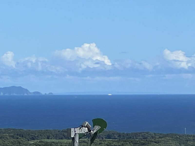
薩摩硫黄島 Satsuma Iwo Jima
枕崎市のほぼ南に位置する薩摩硫黄島です。枕崎市からの距離はおよそ50km。活発な火山島です。
古くは「平家物語」で俊寛が治承2年(1178年)に流刑された地として知られています。
第2次大戦の激戦地の硫黄島は別の島です。
薩摩硫黄島の南東の海底には巨大なカルデラが隠れており「鬼界カルデラ」と呼ばれています。
鬼界カルデラは約7300年前に破局的噴火を起こし、その際に噴出した火砕流は50㎞の海上を渡り九州本土に到達し、当時の南九州の縄文人(文化)や動植物が壊滅的被害を受けたと言われています。活発な噴火活動は現在も続いています。
写真の構図はiPhone の望遠で撮りました。
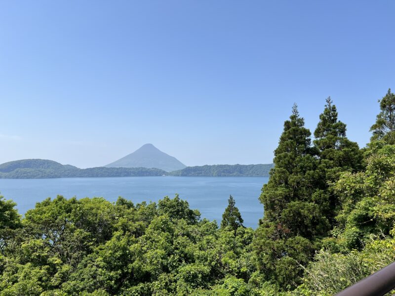
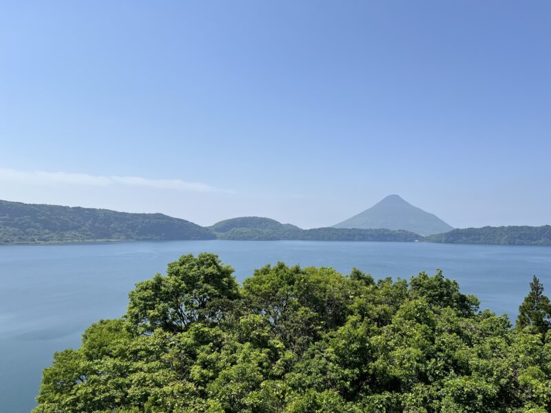
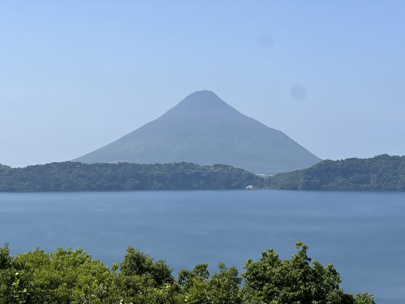
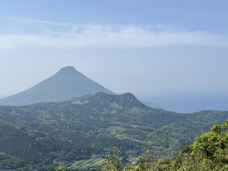
開聞岳と池田湖と阿多カルデラ Mt.Kaimondake, Lake Ikeda & Ata Caldera
開聞岳と阿多カルデラは、どちらも鹿児島県南部にある火山性の地形です。池田湖の歴史は、約5,500年から5,700年前の縄文時代に、火山活動によって形成されました。この火山活動は、地面が陥没してカルデラ湖を形成し、約5立方キロメートルの火山物質が噴出しました。その周囲は約15km、最深部は233mで、九州最大の湖です。
Lake Ikeda, the largest caldera lake in Kyushu, was formed approximately 5,500 to 5,700 years ago during the Jomon period (10,000–300 BCE) as a result of volcanic activity. The volcanic activity led to the collapse of the ground, creating the caldera lake, and ejected approximately 5 cubic kilometers of volcanic materials. The lake’s circumference is about 15km, and its maximum depth is 233 meters, making it the deepest lake in Kyushu.
開聞岳の歴史は、約4,400年前から始まります。当初は浅海域での水蒸気マグマ噴火が始まり、徐々に溶岩を流出する噴火が繰り返され、約2,500年前には現在とほぼ同じ規模の山体が完成しました。その後も噴火を繰り返し、約2,000年前と1,500年前の噴火では噴出量が多く、成層火山体の形成に大きく寄与しました。
The history of Mount Kaimondake (開聞岳) begins around 4,400 years ago. Initially, it started with steam-driven magma eruptions in shallow seas. Gradually, lava-flow eruptions were repeated, and by about 2,500 years ago, the mountain body had formed with roughly the same scale as it is today. After that, eruptions continued, and the eruptions around 2,000 and 1,500 years ago had a large amount of eruption, which greatly contributed to the formation of the stratovolcano.
阿多カルデラとは
まず、阿多カルデラについて説明します。阿多カルデラは、鹿児島湾の出口付近、薩摩半島の南部から大隅半島西岸にかけて広がる巨大なカルデラです。今から約11万年前(さらには約24万年前にも)に、非常に大規模な噴火を起こして形成されました。特に約11万年前の噴火は「阿多火砕流」として知られ、大量の火山灰や軽石を噴出し、南九州の広範囲に堆積させました。この噴火によって地下に大きな空洞ができ、その部分が陥没して現在の巨大なカルデラが生まれました。
開聞岳と阿多カルデラの関係
そして、開聞岳は、この巨大な阿多カルデラの「後カルデラ火山」の一つと考えられています。
- 後カルデラ火山(丘)とは? カルデラが形成された後、そのカルデラ内部や縁の部分で再び火山活動が起こり、新しくできた火山のことです。
- 開聞岳の成り立ち: 開聞岳は、約4,400年前に噴火活動を開始した、比較的「若い」火山です。阿多カルデラができた約11万年前に比べると、ずっと新しい時代に活動を始めました。
- 位置関係: 開聞岳は、阿多カルデラの西側の縁に近い場所に位置しています。これは、阿多カルデラを形成した一連の巨大な火山活動の「その後」に、マグマが再び上昇して噴火し、開聞岳が誕生したことを示しています。
ですので、開聞岳は、阿多カルデラの形成よりはるかに後の時代に噴火を始めた火山ですが、その壮大なカルデラ活動の「舞台」の上で、新しく生まれた火山体であると言えるでしょう。阿多カルデラが形成されたことで、その後の火山活動の「場」が提供され、結果として開聞岳が成長していった、と考えると分かりやすいかもしれません。

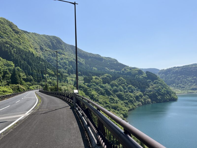
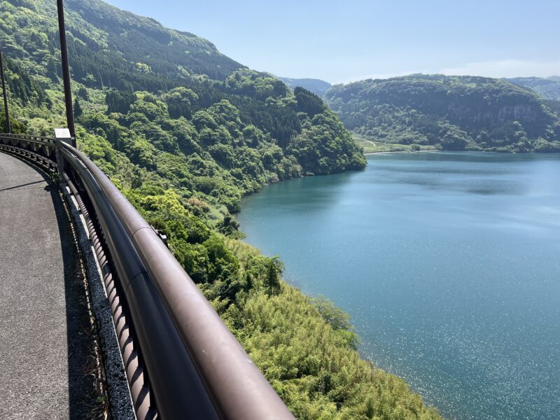
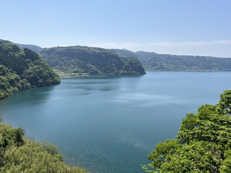
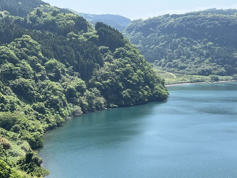
池田湖ので、周囲の崖は切り立ち、砂浜はほとんどなく、崖からすぐ水面に至ります。
最大水深は233mで九州で一番深い湖です。透明度も高く、大ウナギが生息しています。
真偽のほどは分かりませんが、「ネッシー」という恐竜らしいものがみられたりするらしいですが、筆者は見たことはありません。